ICSE Geography Study Guide
How to Solve ICSE Class 10 Topographical Map: 2026 Guide
Topographical map interpretation in ICSE Class 10 Geography (H.C.G. Paper 2) can feel daunting, but it follows strict mathematical and geographic rules. Master the coordinates, scale measurements, and symbol keys to secure every mark in this compulsory section.
Quick answer
To solve an ICSE Class 10 topographical map, locate grid lines by reading Eastings first then Northings, subdivide 2 cm squares into tenths for six-figure coordinates, use a 20-metre contour interval for elevation, and measure distances via scale conversion (2 cm = 1 km) using straight-edge paper or twine.
Key takeaways
- Clarified marking scheme: Question 1 covers 10 marks on toposheets, forming the backbone of the 20-mark compulsory Part I map section.
- Master the 2 mm rule: In a standard 2 cm x 2 cm grid square, every 2 millimetres represents one-tenth unit when deriving a six-figure grid reference.
- Identify river flow direction using three definitive clues: decreasing spot heights, the 'V' contour vertex pointing upstream, and acute tributary junction angles.
- Cite two specific map proofs for every socio-economic question (e.g., yellow wash plus perennial lined wells for agriculture).
- Open Series Map (OSM) sheets G43S7 and G43S10 correspond directly to legacy Survey of India imperial sheets 45 D/7 and 45 D/10.
Get a free study plan and practice questions for your class.
No card. Registering takes about two minutes.
Understanding the ICSE Toposheet Blueprint and Marks Distribution
In the Council for the Indian School Certificate Examinations (CISCE) Class 10 Geography paper (H.C.G. Paper 2), Section A (Part I) carries 30 compulsory marks. Many students and legacy question banks refer to the '20-Mark Toposheet Strategy' because historically, map work comprised a combined 20 marks across map interpretation and India map marking. In current question papers set by CISCE, Question 1 is strictly dedicated to the Survey of India topographical map extract and carries 10 compulsory marks (divided into 5 sub-questions of 2 marks each or 10 single-mark objective questions), while Question 2 carries 10 compulsory marks for the outline map of India. The remaining 10 marks of Part I consist of foundational objective questions covering the broader geography syllabus.
The map extracts supplied in the board examination are published by the Survey of India (SOI). Over the past decade, CISCE transitioned from the legacy imperial sheet extracts (commonly numbered as Sheet No. 45 D/7 and 45 D/10, representing parts of Rajasthan and Gujarat) to the Open Series Maps (OSM), indexed as Sheet No. G43S7 and Sheet No. G43S10. While the grid numbering and cartographic layout remain identical between 45 D/10 and G43S10, the Open Series Maps feature metric adjustments, updated legend layouts, and cleaner contour printing. Understanding this numbering removes exam-day confusion: if your school textbook cites 45 D/10 while the CISCE question paper states G43S10, you are viewing the exact same geographical territory centered around the Banas and Sukli river basins.
Every SOI topographical extract provided in the ICSE examination is drawn to a standardized Representative Fraction (R.F.) of 1:50,000. This ratio is fundamental to every calculation you perform. On this scale, 1 unit on paper equals 50,000 units on the actual ground. Expressed in metric units, 1 centimetre on the toposheet represents 50,000 centimetres (or 500 metres) in reality. Consequently, 2 centimetres on the map equals exactly 1 kilometre on the ground. Because every red grid square on an ICSE toposheet measures precisely 2 cm by 2 cm, each individual grid square covers exactly 1 square kilometre of land area.
Mastering Grid Coordinates: Four-Figure and Six-Figure Grid References
What is the difference between a four-figure and a six-figure grid reference in ICSE? A four-figure grid reference identifies an entire 1 km² grid square, whereas a six-figure grid reference pins down a specific landmark to within 100 metres. Both systems rely on two sets of red numbered grid lines: Eastings (vertical lines whose numerical values increase towards the east, or left-to-right) and Northings (horizontal lines whose numerical values increase towards the north, or bottom-to-top). The universal rule taught by CISCE examiners is 'E before N'—always quote the Easting before the Northing, mimicking the Cartesian coordinate principle (x, y).
To find a four-figure grid reference, locate the southwest (bottom-left) corner of the square housing your feature. Identify the vertical Easting line forming the western edge of that square, then identify the horizontal Northing line forming the southern edge. Combining these two two-digit numbers gives your four-figure reference. For example, if a village lies in a box bounded on the west by Easting 64 and on the south by Northing 31, its four-figure grid reference is written directly as 6431 without spaces or punctuation.
- Locate the feature's pinpoint position inside its 2 cm x 2 cm grid square.
- Read the two-digit Easting line to the immediate left (west) of the feature: e.g., 64.
- Measure how many tenths of the square the feature lies east of that line. Because 2 cm = 20 mm, every 2 mm represents one-tenth (1 unit). If the dot is 8 mm from the western line, 8 mm divided by 2 mm equals 4. Append 4 to the Easting: 644.
- Read the two-digit Northing line to the immediate bottom (south) of the feature: e.g., 31.
- Measure how many tenths the feature lies north of that line. If the dot is 14 mm above the southern line, 14 mm divided by 2 mm equals 7. Append 7 to the Northing: 317.
- Combine the two parts into a single continuous six-digit code: 644317.
The 2 mm Ruler Trap to Avoid
The most frequent blunder evaluated by CISCE examiners occurs when students divide a grid box using millimeters on their plastic rulers without converting to tenths. In standard school rulers, a box is 20 mm across. Students often measure 6 mm and write down '6' as their third digit. That is incorrect. Because the full box is 10 units, 20 mm divided by 10 means each grid tenth equals exactly 2 mm. An offset of 6 mm corresponds to 3 tenths (6 / 2 = 3). Always divide your millimeter reading by 2 to determine your third and sixth digits.
Interpreting Elevation, Contours, and Heights
Contour lines are brown lines drawn on the map connecting places of equal elevation above mean sea level. What does a contour interval of 20 metres signify on a Survey of India map? It means that the vertical distance between any two successive contour lines is strictly 20 metres, regardless of how close or far apart the lines appear horizontally. Spacing indicates the gradient: closely packed contours signify a steep slope or escarpment, widely spaced contours represent a gentle slope, and concentric closed contours with increasing values towards the centre depict a hill or conical peak.
To interpret elevations accurately in ICSE exams, you must differentiate between the four distinct height indicators used by the Survey of India:
- Spot Height (.281): Denoted by a plain black dot followed by a number. It represents the exact surveyed elevation of that specific point above mean sea level in metres.
- Triangulated Height (△ 364): Denoted by a small black triangle followed by a number. It marks a trigonometric survey station whose height was calculated using triangulation geometry.
- Bench Mark (BM 225.5): Inscribed along metalled roads, bridges, or permanent masonry structures, indicating a permanent reference mark carved on physical ground whose height has been precisely fixed.
- Relative Height / Depth (3r, 12r, 15r): Written in small brown or blue print next to embankments, dry riverbeds, well symbols, or sand dunes. The letter 'r' stands for 'relative'. A label of '3r' beside a dry tank or river embankment means that the height from the bed to the crest is 3 metres, not that the ground is 3 metres above sea level.
| Symbol / Notation | Colour on Map | Cartographic Meaning | CISCE Board Answer Inference |
|---|---|---|---|
| Yellow Wash | Yellow | Cultivable agricultural land | Primary occupation is farming/agriculture |
| Green Wash | Green | Forested land / Open jungle | Lumbering, forest gathering, forestry |
| Blue Solid Circle | Blue | Perennial lined well | Availability of subsoil irrigation water |
| Broken Black Line Stream | Black | Seasonal / Non-perennial stream | Region experiences dry climate with erratic monsoons |
| Broken Ground Symbol | Black | Gully erosion / Ravines along riverbanks | Soil erosion, lack of vegetation, uncultivable soil |
| Red Grid Square Box | Red | Eastings & Northings grid (2 cm x 2 cm) | Area = 1 sq km; Ground side = 1 km |
| Notation '3r' near bank | Brown/Blue | Relative height is 3 metres | Height of the embankment above bed level is 3 m |
| Black Zig-Zag Curves | Brown | Contour lines (V-shape) | Apex points upstream; river flows towards open V |
How is Direct and Indirect Distance Measured on an ICSE Topographical Map?
Direct distance is measured as the crow flies between two designated landmarks, such as from the temple in village Sirori to the post office in village Tokra. Place the straight edge of your plastic ruler or a strip of paper across both points, mark the centres of the symbols with a fine pencil, read the distance in centimetres, and divide by 2 to state the real-world distance in kilometres (since 2 cm = 1 km). If the ruler reads 7.4 cm, the ground distance is 7.4 / 2 = 3.7 km. CISCE marking guidelines allow a margin of error of ±1 mm (±0.05 km).
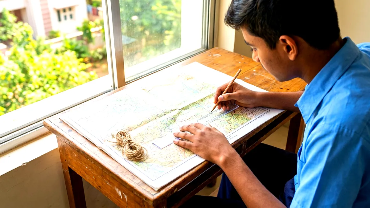
Indirect distance requires measuring along a winding feature, such as a cart track, metalled road, or seasonal stream. How to calculate distance using twine in ICSE toposheet: Take a piece of non-elastic white cotton thread (twine). Make a knot at one end and place it exactly on the starting landmark. Use a sharp pencil point to hold the thread along the subtle bends and curves of the route, pressing it down segment by segment until you reach the destination. Mark the final point on the thread with a pen. Lay the thread flat against the printed linear scale at the bottom of the map sheet to read the value in kilometres and metres directly, or measure it against a metric ruler and divide by 2.
How to Calculate the Area of an Enclosed Region on an ICSE Toposheet
Questions frequently ask candidates to calculate the area of a specific section, such as the area enclosed between Eastings 62 to 67 and Northings 25 to 30. Calculate this using grid squares. Count the number of full grid squares across the length and breadth: Length = 67 - 62 = 5 grid units (5 km); Breadth = 30 - 25 = 5 grid units (5 km). Area = 5 km × 5 km = 25 km². If an irregular feature (such as an open scrub forest or seasonal lake) is specified, count the complete squares (each = 1 km²), add squares covered by more than half, and ignore squares covered by less than half.
River Systems and Drainage Patterns: Direction, Banks, and Formations
What are the common drainage patterns asked in ICSE Class 10 toposheets? Drainage patterns depict how streams and tributaries branch across the terrain. CISCE tests four primary patterns:
1. Dendritic: The stream network resembles the spreading branches of a tree or the veins of a leaf, forming where rocks offer uniform resistance to erosion. 2. Trellis: Tributaries join the main stream at approximately right angles (90 degrees), common in areas with alternating bands of hard and soft rocks. 3. Radial: Streams radiate outwards down the slopes of an isolated central hill or conical dome like spokes on a bicycle wheel. 4. Disappearing / Intermittent: Streams indicated by broken black lines terminating abruptly in porous sandy tracts or inland depressions without reaching a master stream.
- Contour 'V' Shape Rule: When contour lines cross a river valley, they bend into an upstream-pointing 'V'. The apex of the 'V' points towards higher ground (the source), meaning water flows out from the open end of the 'V' toward lower elevations.
- Spot Height Gradient: Compare spot heights along the river course or on adjacent banks. If the northern reach displays spot heights of .280 and .274, while the southern reach shows .252 and .240, the river flows from north to south.
- Tributary Confluence Angle: Tributaries almost universally join the trunk stream pointing downstream at an acute angle, flowing in the direction of the join.
- Left Bank vs Right Bank Identification: Stand mentally facing downstream (the direction in which the water flows). Your right hand corresponds to the river's right bank, and your left hand corresponds to the river's left bank.
Settlement Patterns, Occupations, and Colour Interpretation
What is the difference between nucleated, dispersed, and linear settlement patterns? Nucleated (compact) settlements show red dwelling squares clustered closely together around a shared water body, fertile farmland, or a road crossing. Dispersed (scattered) settlements feature isolated, widely separated huts across hilly, arid, or forested terrain where arable land is scarce. Linear settlements are organized in a distinct single or double row along a transport axis, such as a metalled road, river levee, railway track, or canal embankment.
CISCE questions consistently ask students to infer the primary occupation of residents in a named village. Examiners reject speculative answers; you must furnish visible map evidence:
- Agriculture / Farming: Inferred if the surrounding area is covered with yellow wash (cultivable land) accompanied by perennial lined wells (blue circles) or irrigation canals.
- Forestry / Lumbering: Inferred if the settlement is situated within or adjacent to a green wash area labelled 'Dense mixed jungle', 'Fairly dense scrub', or 'Reserved Forest'.
- Pastoralism / Animal Grazing: Inferred if the map indicates extensive uncultivated open scrub ('Open scrub' in white wash) and stony ground.
- Mining / Quarrying: Inferred if symbols for stone quarries, lime kilns, or brick kilns appear near the settlement.
- Trade / Transport Services: Inferred if the settlement exhibits a convergence of metalled roads, post offices (PO), police chowkis (PS), rest houses (RH), dak bungalows (DB), or periodic market grounds (indicated with dates/months).
Essential Conventional Signs and Quick Evidence Reference Table
The key to scoring a perfect 10/10 in Question 1 lies in rapid symbol decoding. Below is a practical reference mapping common toposheet symbols to their geographical implications as evaluated by CISCE examiners.
Board Exam Answer-Framing Strategy and Preparation Plan
In board exams, students often forfeit simple marks due to incomplete descriptions. When answering a question asking for direction, state the eight-point compass heading clearly (e.g., 'South-West', not merely 'towards the left'). When asked 'from A to B', place your reference compass rose at A and look toward B. If the question asks for the direction of B from A, your vantage point is A.
For proof-based questions, adopt a two-part response structure: state the answer, followed by the specific map symbol and grid location. For example, rather than writing 'The climate is semi-arid because it has sand', write: 'The area experiences seasonal rainfall with an arid/semi-arid climate, evidenced by dry seasonal streams (broken black lines), broken ground along riverbanks, and widespread open scrub in grid square 6533.'
During your revision sessions, practise with authentic extracts of SOI sheets G43S7 and G43S10. When working through sample papers on platforms like Tution Sir, make it a habit to measure lines physically with a wooden ruler and thread rather than estimating visually. Always check whether water symbols are blue (perennial water) or black (dry seasonal depressions), as this single distinction dictates answers on climate, irrigation, and transport.
Frequently asked questions
What is the difference between a four-figure and a six-figure grid reference in ICSE?
A four-figure grid reference identifies an entire 1 km² grid square using the bottom-left Easting and Northing lines. A six-figure grid reference adds tenths within that square to locate a specific point within 100 metres accuracy.
How do you determine the direction of flow of a river on a toposheet?
Trace the spot heights along the banks to find which way elevation drops, check the 'V' shape of contour lines which always points upstream towards the source, and observe tributaries, which join trunk streams at acute angles pointing downstream.
What does a contour interval of 20 metres signify on a Survey of India map?
It means the vertical elevation difference between two consecutive brown contour lines is constant at 20 metres. Close contours denote steep terrain, while spaced contours show gentle slopes.
How is direct and indirect distance measured on an ICSE topographical map?
Measure direct distance along a straight line using a plastic ruler and convert at 2 cm = 1 km. For indirect winding tracks or streams, trace the route with a cotton thread, straighten it against a ruler, and divide by 2.
What are the common drainage patterns asked in ICSE Class 10 toposheets?
The four main patterns are dendritic (branching tree-like), trellis (tributaries joining at right angles), radial (streams flowing outward from a central hill), and disappearing (streams ending abruptly in sand).
What do relative height notations like 3r or 15r mean on an ICSE map extract?
The number before 'r' denotes the relative height or depth in metres from base to summit of that specific feature (such as an embankment, dune, or dry tank), not its total height above sea level.
What is the difference between spot height, triangulated height, and bench mark?
A spot height (.250) gives the surveyed elevation of a point, a triangulated height (△ 320) marks an elevation established via triangulation, and a bench mark (BM 210) is an official elevation carved into permanent masonry.
Sources and official links
Exam rules and notifications change. Confirm dates, fees and eligibility on the official website before acting. Spotted an error? Email support@tutionsir.com. See our editorial policy.
Keep learning
How to Score 95 Percent in Class 10 CBSE: 2026 Strategy
Jumping from the comfortable 80 percent bracket to a 95 percent score in CBSE Class 10 requires shifting from
Read →How to Solve Case Based Questions in CBSE Class 10
CBSE has raised competency-focused questions to 50 percent of the Class 10 board examination, turning Section
Read →CISCE Exam Rules Frisking AI Gadgets: 2027 Exam Guide
The Council for the Indian School Certificate Examinations has authorised centre heads to frisk ICSE and ISC c
Read →Do not let another week go by without a plan
Knowing the ICSE dates is step one. Using the weeks before them well is what decides marks. Register free now and start with the one topic that worries you most. Small daily practice beats a last-minute rush.
- Free plan, no card needed
- Ask any doubt and get a step-by-step answer
- Practice questions with explanations, chapter by chapter
Free plan, no card needed. Your progress is saved to your account.